The short answer: Black Elk Peak is the highest point in South Dakota at 7,244 feet, and the shortest trail to the top is Trail 9 from Sylvan Lake in Custer State Park. The park lists it at 3.3 miles one way and rates it moderate to strenuous.
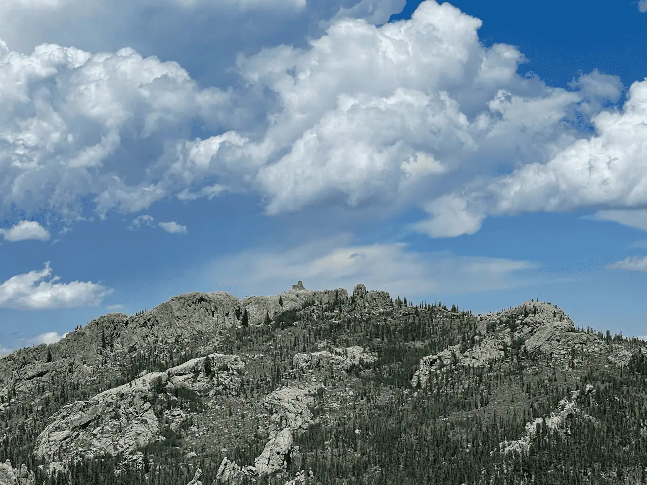
Where the Peak Is
Black Elk Peak sits just outside Custer State Park, in the Black Elk Wilderness of the Black Hills National Forest, and the two most popular trails to the top start inside the park. It was called Harney Peak until 2016, so older maps use that name. If you’re driving yourself, the park lists its entrance license at $25 per vehicle for 1 to 7 days.
The Two Main Trails
- Trail 9: The park lists this one at 3.3 miles one way and 2 to 4 hours. It’s the most traveled route and the shortest, and it starts just across the footbridge to the swimming beach at Sylvan Lake.
- Trail 4: The park lists this one at 3.5 miles one way and 3 to 4 hours. It starts at the far southeast corner of the day use parking area, connects to the Little Devil’s Tower spur and ends at Norbeck Trail 3, which meets Trail 9 on the way to the top.
The park warns that the junctions with Norbeck Trail 3, Grizzly Creek Trail 7 and Trail 9 are easy to miss, especially on the way back, so carry a map. The park’s general stores sell topographic maps, and the free Avenza Maps app uses your phone’s GPS to show where you are when there’s no signal. If you meet a wild animal on the trail, stay at least 100 yards away. If you’re exploring on your own, our guides to the Cathedral Spires and Black Hills trails cover more of this area.
What’s at the Top
A stone fire lookout tower stands on the summit. The Civilian Conservation Corps built it in 1938 and finished it the next year, and lookouts staffed it until 1967. The tower is on the National Register of Historic Places.
Seeing the High Country With Us
Our private Mount Rushmore and Black Hills Scenic Tour drives Needles Highway and stops at Sylvan Lake.